



Municipal Campsite of Les Cordeliers

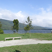
This campsite is a peaceful and relaxing place surrounded by nature. Located at the starting point of many hiking trails, it is just 100 meters from the beach and features a children's playground as well as a designated beach area for dogs.
On a fully enclosed site that was completely renovated in 2016. It is equipped with a waste disposal area for camper vans and offers picnic tables and barbecues. You also have the option to organize your own barbecue on the beach, where fixed barbecues are available.
Practical information
Equipments
-
Play area,
-
Fenced grounds,
-
Bar,
-
Shady grounds,
-
Terrace,
-
Toilets,
-
Camper van service area,
-
washing-up bowl,
-
Automatic barrier,
-
Barbecue,
-
Boules area,
-
Water connections,
-
Electrical connections,
-
Car park,
-
Phone box/phone point,
-
Restaurant,
-
Unequipped pitches
Services
-
Night reception,
-
Pets welcome,
-
Reception,
-
Motorhomes allowed,
-
Breakfast,
-
Daytime supervision,
-
Pets supplement,
-
Cleaning with supplement,
-
Bread store,
-
Wi-fi,
-
Gas store,
-
Tourist brochures,
-
Mobile home hire,
-
Cleaning/housekeeping at end of stay,
-
Restaurant,
-
Night watch,
-
Grounds closed at night,
-
Fast food,
-
Repair kit,
-
Animals accepted in the accommodations,
-
Ice cream parlour,
-
Drinking water
Comfort
-
140 cm bed,
-
Hot showers,
-
Hand wash basins with hot water,
-
Heated WC,
-
Separate toilet,
-
Bed 90 cm
Activities
-
Fishing,
-
Boules,
-
Hike on foot,
-
Mountain biking,
-
Cycle sports,
-
Water sports,
-
Various sports,
-
Pedestrian sports
Time schedule
From 05/01/26 to 09/30/26
-
Monday :
Open
-
Tuesday :
Open
-
Wednesday :
Open
-
Thursday :
Open
-
Friday :
Open
-
Saturday :
Open
-
Sunday :
Open
-
Jours fériés :
Closed
Prices
Payment method
-
Bank/credit card,
-
Cash,
-
Travellers Cheque
See more
-
Les petits mollets - Green path
Place: Pierre-Châtel
Elevation 210m
-
Le Canier - blue path
Place: Pierre-Châtel
Elevation 390m

-
N°06 Le Paradis red-path
Place: Pierre-Châtel
Elevation 680m

-
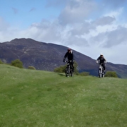
N°09 Tour du Grand Serre - black path
Place: Pierre-Châtel
Elevation 1440m
-
N°07 La Croix de Gouret - black path
Place: Pierre-Châtel
Elevation 1170m

-
N°11 Le Sénépy - black path
Place: Pierre-Châtel
Elevation 1630m

-
N°19 Les Gros Mollets (La baraque du Jas, departure : Pierre Chatel) - black path
Place: Pierre-Châtel
Elevation 2550m

-
Lake Pierre Châtel
Place: Pierre-Châtel

-
N°06 Le Paradis VTT - Rouge
Place: Pierre-Châtel
Elevation 680m

-
N°21 Les Tunnels - green path
Place: Pierre-Châtel
Elevation 50m

-
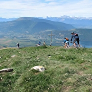
N°07 La Croix de Gouret VTT - Noir
Place: Pierre-Châtel
Elevation 1170m
-
N°05 Le Tour des Lacs (intinerary around the lakes) - red path
Place: Pierre-Châtel
Elevation 1030m

-
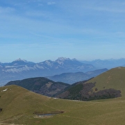
N°18 Les Alpages VTTAE - Noir -
Place: Pierre-Châtel
Elevation 1570m
-
La Pierre Percée - red path
Place: Pierre-Châtel
Elevation 630m

-
N°08 La Pierre Percée VTT - Rouge
Place: Pierre-Châtel
Elevation 630m

-
N°35 Mountainbike itinerary La Matheysienne - black path
Place: Pierre-Châtel
Elevation 4443m

-
N°09 Tour du Grand Serre VTTAE - Noir
Place: Pierre-Châtel
Elevation 1440m

-
N°19 Les Gros Mollets (La baraque du Jas depuis Pierre Chatel) VTTAE - Noir
Place: Pierre-Châtel
Elevation 2550m

-
N°35 La Matheysienne VTTAE - Noir
Place: Pierre-Châtel
Elevation 4443m

Go there
Latitude : 44.966679
Longitude : 5.781023
Height : 939
38119 Pierre-Châtel
Go there
Information updated on 29/05/2026
by Matheysine Tourisme


