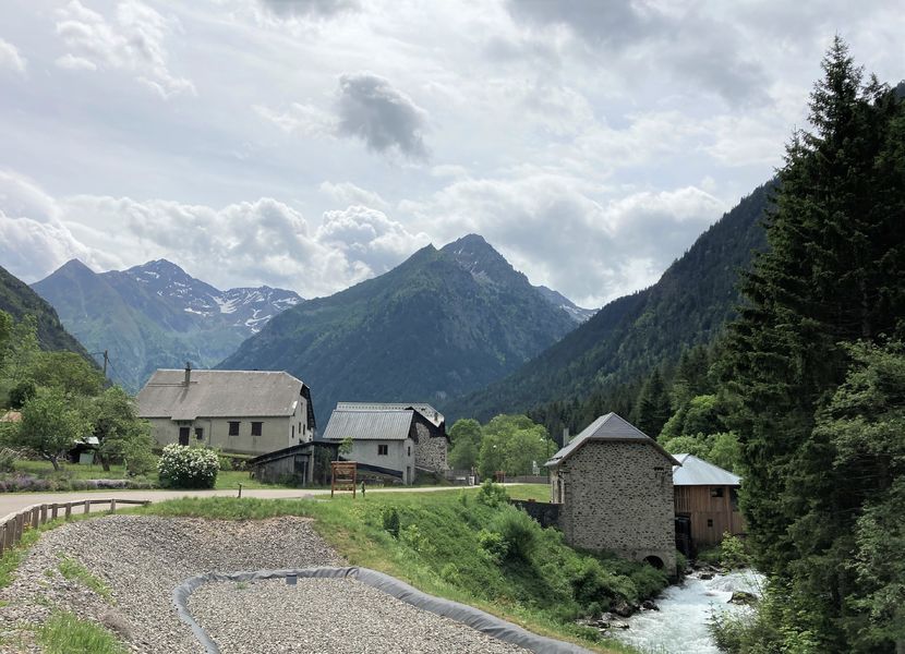
Hamlets of Valjouffrey

A walk in the bottom of the valley, in the cool, to discover the rich heritage of these mountain hamlets where the inhabitants have always composed with their environment to work, cultivate and meet their needs.
Departure from Ségouins, direction La Chapelle en Valjouffrey via Les Châtelards and Entre les Hors. From there, reach La Chalp en Valjouffrey via Sur La Chapelle, Les Cognets and La Draye. Continue to Les Faures campsite via Le Pinet and Vorzines, then return to Les Ségouins via Les Fauchiers, Les Fauries, Les Faures, Malserret, Les Rozays and Pont Baléard.
Discover on the way, the swing saw restored by a local association. The Ségouins footbridge and the theme trail on "Water in all its states" await you between Les Ségouins and Pont Baléard.
Route details
Start from "Les Ségouins", towards "La Chapelle en Valjouffrey" passing by "Les Châtelards" & "Entre les Hors". From there, reach "La Chalp en Valjouffrey" by "Sur la Chapelle", "Les Cognets" and "La Draye".
Continue up to "Camping des Faures" by "Le Pinet" & "Vorzines", then way back to the "Ségouins" by "Les Fauchiers", "Les Fauries", "Les Faures", "Malserret", "Les Rozays" & "Pont Baléard".
-
Pets welcome,
-
Accommodation
Car park
Opening
All year round daily.
Subject to favorable snow and weather conditions.
Informations to download
Discover more
-
Balade pédestre le long du canal des Charmettes
Place: Valjouffrey
Elevation 250m
-
Campsite des Faures
Place: Valjouffrey
-
Cascade de la Pisse
Place: Valjouffrey

-
Gîte of the Arias
Place: Valjouffrey

-
Gite Les Marmottes
Place: Valjouffrey
-
La Pisse Waterfall
Place: Valjouffrey
Elevation 270m
-
Réserve Naturelle de la Haute Vallée du Béranger
Place: Valjouffrey
Go there
Latitude : 44.872057
Longitude : 6.028392
Height : 1020
Route D117
38740 Valjouffrey
Go there
Information updated on 19/10/2026
by Matheysine Tourisme