



Col de Chamrousse - mountain pass

Start out from Uriage-les-Bains where the marked ascent to Col de Chamrousse follows the last 19 km of the 13th stage of the 2014 Tour de France that started in Saint-Étienne.
A long, steady climb in the shade of the fir trees.
Route details
At the roundabout near Uriage golf course, take the D111 to Chamrousse. On arrival in Chamrousse near Roche Béranger - Chamrousse 1750, turn right onto Rue des Essendolles then continue along Avenue du Père Tasse to Chamrousse pass at an altitude of 1,795 m.
Opening
From 01/05 to 31/10 daily.
Subject to favorable weather.
Discover more
-
Hiking and trail activities - Chamrousse Hike Park
Place: Chamrousse

-
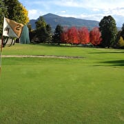
Uriage Golf
Place: Vaulnaveys-le-Haut
-
Achard lake
Place: Chamrousse

-
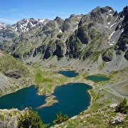
Robert lakes
Place: Chamrousse
-
Cycling route: Uriage - Chamrousse (Luitel road side)
Place: Chamrousse
Elevation 1384m

-
Electric bike route: Uriage - Chamrousse (Luitel road side)
Place: Chamrousse
Elevation 1384m

-
Road bike itinerary: Uriage - Chamrousse (uphill on Seiglières side)
Place: Chamrousse
Elevation 1200m

Go there
Latitude : 45.131124
Longitude : 5.819032
Height : 413
avenue du Golf
38410 Vaulnaveys-le-Haut
Go there
Several public transport lines serve Uriage from Grenoble:
- regular bus service: N93 (to/from Grenoble) [merger of former bus lines T87, Transaltitude].
- seasonal bus service (summer and winter): Destination neige ou nature [former Skibus / Estibus 707]
Vehicles on these routes are equipped with bike racks. Please enquire in advance.
Information updated on 24/08/2026
by Isère Attractivité

