


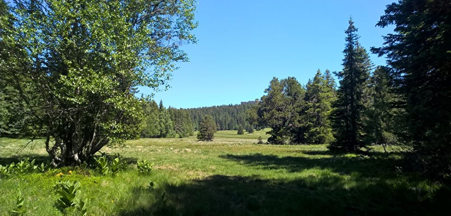
Chamrousse 1750 - Arselle plateau, via the connecting trail

Departure point: Chamrousse 1750 - Office de Tourisme. Arrive at the entrance to the beautiful Arselle plateau.
Round trip: 2h20 (7.8km)
A relaxing walk across the woods, where you will contemplate the Grenoble valley, discover a mixed forest (spruce trees, fir trees, goat willows, green alders, sorbs, maples and birches). You might see a roe deer eating on the edge of the path, or follow the tracks left by our forest hosts.
Route details
Pets welcome
-
Parking nearby,
-
Public WC,
-
Picnic area
Opening
All year round daily.
Discover more


Go there
Latitude : 45.109452
Longitude : 5.875797
Height : 1750
Chamrousse 1750
38410 Chamrousse
Go there
Public transport - stop Chamrousse 1750 - Roche Béranger :
- regular bus service all year round: N93 (to/from Grenoble), stop "Chamrousse 1750" [merger of former bus routes T87, Transaltitude and Destination nature Skibus / Estibus 707].
- bus line / shuttle on reservation weekdays excluding public holidays: Flexo 57 to/from Uriage [former TAD TouGo transport on demand - line G701].
- winter season resort shuttle: "Centre Commercial (1750)" stop (to/from Chamrousse 1650 - Recoin and Chamrousse 1600 - plateau de l'Arselle/nordic area)
Further information at https://www.itinisere.fr
Information updated on 28/08/2025
by Office du Tourisme de Chamrousse


