



MTB track - Transhumance

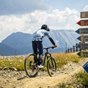
Medium-difficulty downhill mountain bike trail (blue level) in Chamrousse 1750 and 1650.
Start: Chamrousse 1750 - Roche Béranger (1700m)
Finish: Chamrousse 1650 - Recoin (La Croix gondola)
Duration: 6 minutes
One of Chamrousse's 3 blue downhill mountain bike trails for beginners.
Downhill bikes and scooters are allowed on the blue (and green) trails, where you don't need to take your wheels off the ground.
Route details
-
Equipment hire,
-
Accessible via ski lift
-
Parking nearby,
-
Public WC
Opening
From 01/07 to 31/08 daily.
Bérangère chairlift opening times summer 2024: 9.15am-5pm.
Informations to download
Discover more
-
Mountain biking - Chamrousse Bike Park
Place: Chamrousse
-
MTB track - Blanchon
Place: Chamrousse
Elevation -485m

-
MTB track - Panoramique
Place: Chamrousse
Elevation -275m

-
MTB track - la Chamroussienne
Place: Chamrousse
Elevation -580m

-
MTB track - Rhodos
Place: Chamrousse
Elevation -275m

-
MTB track - Tétras
Place: Chamrousse
Elevation -590m

Go there
Latitude : 45.115218
Longitude : 5.893124
Height : 2250
Chamrousse 1750 / 1650
38410 Chamrousse
Go there
Resort road access from Grenoble: Rocade Sud > exit no. 2 "Uriage" > Road n°111 (RD 111) on the Luitel or Seiglières side.
Recommended parking: main parking lot (P3), 390 avenue du Père Tasse (approx. 100 m and 2-minute walk from the Bérangère chairlift).
Public transport - Chamrousse 1750 - Roche Béranger stop:
- regular bus service all year round: N93 (to/from Grenoble), "Chamrousse 1750" stop [merger of former bus routes T87, Transaltitude and Destination neige Skibus / nature Estibus 707].
Vehicles on this route are equipped with bike racks. Please enquire in advance.
Information updated on 20/08/2025
by Office du Tourisme de Chamrousse


