



From Obiou to Mont-Aiguille - Cycling path n°7

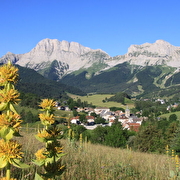
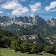
A pleasant, varied route through the back roads of the Trièves, taking in the scenery on both the Vercors and Dévoluy sides of the region, and admiring two emblematic peaks: Obiou and Mont Aiguille!
Route details
Opening
All year round.
More details
Informations to download
Tips
You'll find everything you need for minor repairs at every Tourist Office branch.
Discover more
-
Between Trièves and Diois - Cycling path n°8
Place: Clelles
Elevation 1763m

-
The East Vercors Balcony - Cycling path n°5
Place: Monestier-de-Clermont
Elevation 854m
-
Villages in the heart of the Trièves - Cycling path n°2
Place: Mens
Elevation 574m

-
From the foothills of the Vercors to those of the Dévoluy - Cycling path n°9
Place: Mens
Elevation 1882m

-
Panoramic views of the Trièves - Cycling path n°3
Place: Mens
Elevation 716m

-
From Grand-Veymont to Deux-Sœurs - Cycling path n°4
Place: Gresse-en-Vercors
Elevation 655m

-
From one bank of the Gresse to the other - Cycling path n°6
Place: Monestier-de-Clermont
Elevation 1168m
Go there
Latitude : 44.827276
Longitude : 5.622635
Height : 768
38930 Clelles
Go there
SNCF Line 63 GRENOBLE-VEYNES-GAP (Clelles-Mens station)
Information updated on 02/01/2025
by Office de Tourisme du Trièves


