



Chamrousse 1650 - Croix de Chamrousse

Departure point: Tourist Office at Chamrousse 1650 - Recoin.
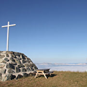
A hike to the top of the resort (Chamrousse 2250 - Croix de Chamrousse) from the Recoin station.
For the round trip, allow 3 hours (10km).
360° views of the Vercors, Chartreuse, Oisans and Belledonne ranges.
Arrival at the top of the resort in the Panoramic Park with belvederes and Himalayan footbridge.
Signposting planned for August.
Route details
Pets welcome
-
Public WC,
-
Car park,
-
Parking nearby,
-
Free car park
Opening
From 01/05 to 30/11 daily.
Informations to download
Discover more


Go there
Latitude : 45.125491
Longitude : 5.878946
Chamrousse 1650
38410 Chamrousse
Go there
Station road access from Grenoble: Rocade Sud > exit no. 2 "Uriage" > Route départementale 111 (RD 111) on the Seiglières side.
Public transport - Chamrousse 1650 - Recoin stop:
- regular bus service all year round: N93 (to/from Grenoble), "Chamrousse 1650" stop (merger of former T87, Transaltitude, Destination neige Skibus / nature Estibus 707)
Good to know - another stop less than 500m away (Place de Belledonne, near the Tourist Office):
- transportation by reservation on weekdays, excluding public holidays: Flexo 57 (to/from Uriage), "Chamrousse - Le Recoin" stop (former TAD TouGo - line G701)
- winter season resort shuttle: "Télécabine (1650)" stop (to/from Chamrousse 1750 - Roche Béranger and Chamrousse 1600 - plateau de l'Arselle/nordic area).
Information updated on 11/08/2026
by Office du Tourisme de Chamrousse


