



4 - Forest Express Trail

Before your visit
The periods during which the trails are accessible vary from year to year depending on snow cover and weather conditions. In addition, trail conditions can change rapidly after a weather event and are not checked daily. If you encounter a section of the trail that is in poor condition or dangerous, turn back and report it to the tourist office upon your return.
Short route: perfect for a quick workout or an introduction to mountain trail running, all while staying in the shade and enjoying the coolness of the forest!
Terrain difficulty: Very hilly, with a technical and challenging descent featuring a few sections with a 30% grade over 1 kilometer, as well as forest trails with some rocks and roots.
Rideability: Generally good, except for one very steep descent.
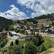
Beautiful views of the Romanche Valley and the Ecrins Massif await you in a varied setting! Breathtaking views down toward the Col du Lautaret between La Meije and the Emparis Plateau.
Through July, you’ll pass through alpine pastures with cows and bulls grazing in the meadows. Be sure to close gates securely if there are no designated green crossings for people, slow down, and remain calm when approaching the herds.
Route details
From Place des Orgières, head toward the RV park on Rue de la Piscine. Pass to the left of the RV park and enter the forest, following the signs for “PLANCET” and “Combe du Goutail” (the lumberjack trail).
At Combe du Goutail, follow the signs for Plancet again on your left.
When you reach Plancet at the picnic table, turn left onto the grassy, vehicle-accessible trail. You’ll come to a wide dirt path marked “Auris – Station”; follow “Combe Fréry” and continue until you return to the resort below the swimming pool.
-
Pets welcome,
-
Motorhomes allowed,
-
Drinking water
-
Restaurant,
-
Free car park,
-
Car park,
-
Public WC,
-
Charging stations for electric vehicles,
-
Bar,
-
Picnic area,
-
Play area
Opening
From 15/04 to 31/10 daily.
The periods during which the trails are accessible vary from year to year depending on snow cover and weather conditions. In addition, trail conditions can change rapidly after a weather event and are not checked daily. If you encounter a section of the trail that is in poor condition or dangerous, turn back and report it to the tourist office upon your return.
Subject to favorable weather.
More details
Reserved space 330 cm wide < 100 m from the site
Informations to download
Discover more
-
1 - La Chapelle Express Trail
Place: Auris-en-Oisans
Elevation 190m
-
2 - Les Sûres 1860 via the Col de Maronne and the forest
Place: Auris-en-Oisans
Elevation 270m

-
5 - The descent through the 21 hairpin turns of Piégut via Maronne and Les Sûres
Place: Auris-en-Oisans
Elevation 335m

-
6 - Piégut Forest and its 21 switchbacks; return via the Mine
Place: Auris-en-Oisans
Elevation 430m

Go there
Latitude : 45.056244
Longitude : 6.0782
Height : 1600
38142 Auris-en-Oisans
Go there
Place à l'entrée de la station où se trouve l'Office de tourisme.
Information updated on 29/07/2026
by Oisans Tourisme


