



Croix de Chamrousse by mountain bike / VTTAE

Very difficult mountain bike tour (black level) to the top of Chamrousse 2250 - Croix de Chamrousse.
Estimated time based on an average speed of 6km/h.
Same estimated time by mountain bike or e-MTB.
Variation: possible descent via the green trail at the "Blanchon" Bike Park.
Mountain bikes can be hired from the resort's rental companies (at Chamrousse 1650, 1700 and 1750).
Supervision at Chamrousse 1750 with the Moniteur Cycliste Français (MCF) school.
Route details
-
Pets welcome,
-
Accommodation,
-
Restaurant
-
Parking nearby,
-
Public WC
Opening
From 01/06 to 30/08 daily.
Informations to download
Discover more
-
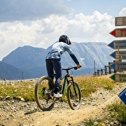
Mountain biking - Chamrousse Bike Park
Place: Chamrousse
-
Teo Mountain on mountain bike / ATV
Place: Chamrousse
Elevation 147m

-
Tour of the Arselle plateau by mountain bike / ATV
Place: Chamrousse
Elevation 225m

-
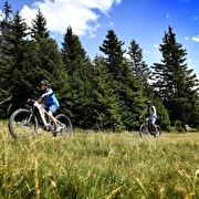
Tour de Chamrousse mountain bike / VTTAE
Place: Chamrousse
Elevation 492m
-
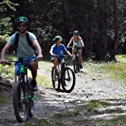
TEMPORARILY CLOSED - Mountain biking trails and e-MTB trails in Chamrousse
Place: Chamrousse
-
MTB track - Blanchon
Place: Chamrousse
Elevation -485m

Go there
Latitude : 45.109852
Longitude : 5.876399
Height : 1750
Chamrousse 1750
38410 Chamrousse
Go there
Resort road access from Grenoble: Rocade Sud > exit no. 2 "Uriage" > Route départementale 111 (RD 111) on the Luitel or Seiglières side.
Recommended parking: main parking lot (P3), 390 avenue du Père Tasse (approx. 100 m, 2-minute walk).
Public transport - Chamrousse 1750 - Roche Béranger stop:
- regular bus service all year round: N93 (to/from Grenoble), "Chamrousse 1750" stop [merger of former bus routes T87, Transaltitude and Destination neige Skibus / nature Estibus 707].
- bus line / shuttle on reservation weekdays excluding public holidays: Flexo 57 to/from Uriage [former TAD TouGo transport on demand - line G701].
Further information at https://www.itinisere.fr
Information updated on 31/08/2026
by Office du Tourisme de Chamrousse


