Itinerary no. 10 "The Bigues Trail"
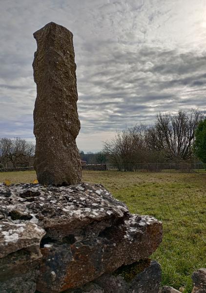
This challenging itinerary provides a wonderful sample of all that our local landscape has to offer. Explore the northern tip of Isère with its quarries, forests, lakes, and vineyards dotted with "bigues" (planted stone posts supporting the vines), not forgetting all the viewpoints and the lovely panoramas of the River Rhône.
From Blue Valley, head for the hamlet of Vassieu and cycle between the quarries of Grosse Pierre, Les Tiennes and Pont Bout (optional loop). Cross Marieu hamlet and follow part of the Bigues trail to reach Parmilieu. Between fields and forestland, you'll pass another quarry before reaching Torjonas, then climb to the limestone plateau, towards Amblérieu and the lake. You'll also pass the Côtes de Sarcalin and Côte du Pain hills to reach the D65 road (caution required) and turn right at a locality called "Le Serpay" before passing the Côte Corbeille slopes. You'll then climb towards the caves of La Balme and cross the Coteaux de St Roch Environmentally Sensitive Area, as well as Suptilieu and Le Devin. You'll then head North through Serverin Forest before returning southwards to Lecazat quarry and joining the Côte de St Vérand itinerary which offers panoramic views. You'll follow this hillside down to Roche Ronde where you'll join the Rhône towpath to reach the Blue Valley site.
Route details
Motorhomes allowed
-
Car park,
-
Public WC,
-
Picnic area
Opening
All year round daily.
Subject to favorable weather.
Informations to download
Discover more


Go there
Latitude : 45.824231
Longitude : 5.420814
38390 Montalieu-Vercieu
Go there
Information updated on 07/07/2025
by Office du Tourisme Les Balcons du Dauphiné