



Le Puy - hiking from Saint-Christophe-en Oisans

A hike for all the family, with beautiful panoramic views over the Vénéon Valley.
TECHNICAL INFORMATION:
Start: Car park Saint-Christophe-en-Oisans
Height difference: 130 m
Duration: 1 h outward journey and 0.45 h return journey
Distance: 3.4 km
Difficulty :
Hiking: Easy
ITINERARY:
In Saint-Christophe-en-Oisans, at the cemetery, take the tarmac road up to the Hameau des Roures, then follow the path on your left to the footbridge over the torrent du Diable. A few hairpin bends in the forest then lead to the Vierge du Collet (finish of the via ferrata) overlooking the valley. The path then climbs quietly up through cherry and hazelnut trees to the hamlet of Le Puy, which used to be inhabited all year round and even had a school.
Today, this small hamlet has been completely restored by local families and lovers of this superb perch with its unobstructed view of Lauranoure and the village of Lanchatra.
Map and Topo :
TOP 25 IGN 3236 AND
Topo map OBP n°5 (Oisans au Bout des Pieds), trail 523/504
THINGS TO SEE ALONG THE WAY :
- The village of Saint-Christophe-en-Oisans
- The cemetery, a magnificent reminder of the history of mountaineering in the Écrins massif.
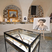
- The "Mémoires d'alpinisme" museum
- The Virgin of Collet
Route details
Pets welcome
Opening
From 15/05 to 31/10 daily.
Subject to favorable snow and weather conditions.
Informations to download
Discover more

Go there
Latitude : 44.95815
Longitude : 6.175966
Height : 1464
405, route de la Bérarde
38520 Saint-Christophe-en-Oisans - La Bérarde
Go there
Information updated on 03/07/2026
by Oisans Tourisme


