



Le tour du lac Petichet

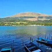
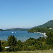
Alternating passages near lakes and more distant viewpoints, this walk accessible to all is an opportunity to get to know the Matheysin plateau.
Alternating between the proximity of the lake and more distant points of view, this tour, accessible to all, will give you a global vision of the country and will make you discover hidden elements of our heritage, such as the ruins of the Gothic chapel of Saint -Théoffrey.
Route details
Departing from Saint-Théoffrey Plage, follow direction Saint-Théoffrey - Les Berlioux via Pétichet, Le Pré Rond, Les Gonthéaumes, Touche and Bouis. From Berlioux, take the direction of Les Théneaux, passing by Serre de la Croix, Eglise Romane, Le Pré de l'Essart, la Croix des Théneaux, Moularet and Rapaille. Arrived at Carrefour Les Mollies, return to Saint-Théoffrey Plage via Champ du Lac and La Fayolle.
Car park
Opening
All year round daily.
Subject to favorable weather.
More details
Not accessible in a wheelchair
Informations to download
Discover more

Go there
Latitude : 44.996957
Longitude : 5.777084
Height : 944
38119 Saint-Théoffrey
Go there
St Théoffrey est situé à 31 km au Sud de Grenoble par la N85.
Depuis Grenoble prendre l'autoroute A48, sortie 8 puis direction Gap Briançon Vizille Stations de l’Oisans rejoindre la N85 par Vizille - Laffrey ou la D529 par la Motte d'Aveillans
Depuis Gap prendre la N85 direction Corps, La Mure
Information updated on 09/10/2026
by Isère Attractivité


