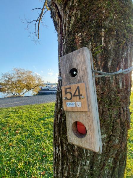
Orienteering trail at the Vallée Bleue, playful Course for Children
12 posts. The aim of orienteering is to find your bearings using natural and artificial elements (trees, rocks, symbols, signs,...).
At each post, punch your card using the red clip at the top.
This course was created in collaboration with Isère Tourisme and the Ligue Rhône Alpes Course d'Orientation
Route details
-
Pets welcome,
-
Tourist brochures
-
Picnic area,
-
Covered picnic area,
-
Toilets,
-
Public WC,
-
Parking nearby
Opening
All year round daily.
Subject to favorable weather.
Informations to download
Discover more
-
La Vallée Bleue outdoor recreational centre
Place: Montalieu-Vercieu

-
Tourist information point
Place: Montalieu-Vercieu

-
Orienteering trail at the Vallée Bleue, 'Lac des Pêcheurs' Red Course
Place: Montalieu-Vercieu
-
Orienteering trail at the Vallée Bleue - Blue Course
Place: Montalieu-Vercieu
-
Blue Valley Geocaching Trail
Place: Montalieu-Vercieu
-
Montalieu-Vercieu
Place: Montalieu-Vercieu

Go there
Latitude : 45.824242
Longitude : 5.420736
9 rue de la Capitainerie
38390 Montalieu-Vercieu
Go there
Information updated on 02/03/2026
by Office du Tourisme Les Balcons du Dauphiné