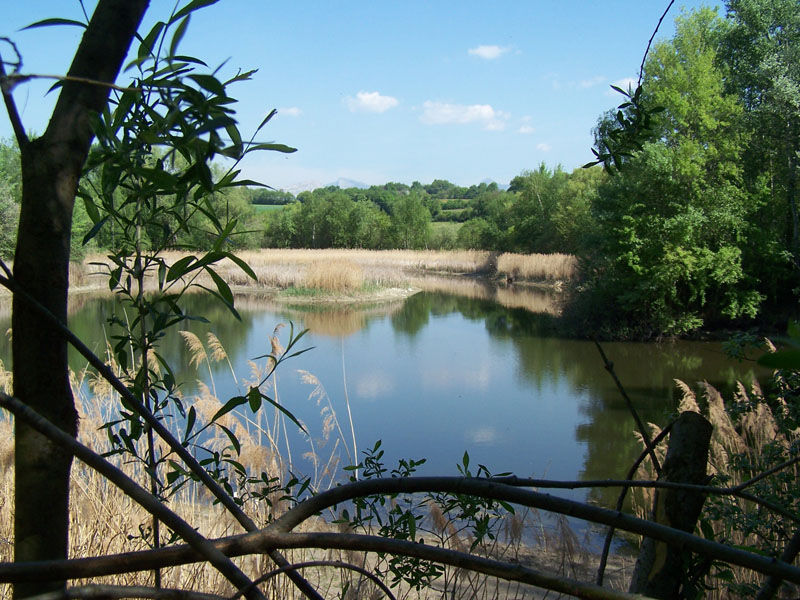
Réserve Naturelle de l’étang de Haute-Jarrie

The Réserve Naturelle de l'Etang de Jarrie is home to a fragile ecosystem comprising a body of water, reed beds, wet meadows and wooded islands. An observatory lets you discover the wildlife that lives there. Access to this site is restricted.
The commune, aware of the pond's rich biodiversity and fragility, protected the site in 1984 as a Voluntary Nature Reserve, which became a Regional Nature Reserve in 2005. These classifications have enabled the fauna and flora of this fragile wetland to be preserved and studied under successive management plans.
The Etang de Haute-Jarrie Reserve covers 10.5 ha of water, wetlands and meadows. It is part of a 21-hectare protection perimeter, which includes the pond's water supply zone. The natural wealth of this small reserve is exceptional: Little Bittern, Marsh Copper, Isosceles Aeschne, Marsh Thelyptera, Viper's Snake...
The Reserve is open to the public along the paths bordering the pond and its channels. The northern part of the reserve is not accessible, in order to preserve quiet areas for wildlife.
For further information on the accessibility of the Reserve, please visit our website: www.rnr-drac-jarrie.fr
Parking lot opposite the Reserve.
Observatory accessible to wheelchair users.
No pets allowed.
Good to know
An ideal place for educational family walks in a protected natural setting, where you can meet migratory birds and prestigious species...
On-site signage provides information on the environment, plants and species.
Practical information
Equipments
-
Parking nearby,
-
Picnic area
Services
-
Educational visits,
-
Themed tour,
-
Guided tours
Time schedule
From 01/01/26 to 12/31/26
-
Monday :
Open
-
Tuesday :
Open
-
Wednesday :
Open
-
Thursday :
Open
-
Friday :
Open
-
Saturday :
Open
-
Sunday :
Open
-
Jours fériés :
Closed
Prices
Free of charge. The Reserve manager organizes visits for the general public and schoolchildren all year round. For further information, contact 04.76.98.38.57 or reservesnaturelles@grenoblealpesmetropole.fr.
Download documents
Tips
An ideal place for educational family walks in a protected natural setting, where you can meet migratory birds and prestigious species...
On-site signage provides information on the environment, plants and species.
See more
-
Saint- André - Champagnier
Place: Champagnier

-
Saint-Etienne Church
Place: Jarrie

-
The Jarrie-Champagnier interpretation trail
Place: Champagnier
Elevation 250m
-
Parcours VTT Sur les traces de la famille Jouvin
Place: Jarrie
Elevation 406m

-
Boucle vélo de Jarrie
Place: Bresson
Elevation 345m

-
Boucle vélo de Jarrie
Place: Bresson
Elevation 345m
-
Hiking in the pond of Jarrie
Place: Jarrie
Elevation 310m

Go there
Latitude : 45.120068
Longitude : 5.744369
Height : 378
38560 Jarrie
Go there
Free parking nearby. Dogs not allowed. Only part of the riverbank is accessible.
Information updated on 24/08/2023
by Office de Tourisme Grenoble Alpes