



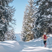
Snowshoe trail in Le Collet

Come and enjoy the sunshine and superb views from Le Collet with your snowshoes on!
There are seven marked snowshoe trails in the resort:
- The Plateau de la Ramée loop is easy, 1.8 km long with an elevation gain of 40 m (1 hour). Departure from Prérond
- The Mouilles Loop, which is of intermediate difficulty and 3.9 km long with an elevation gain of 185 metres (2 hours 15 minutes) in the forest.
- The Chalet des Mouilles Loop, which is easy, 3.4 km long with an elevation gain of 110 metres (1 hour 45 minutes) in the forest
- ‘Le nid de l'aigle’ loop: difficult, 4.6 km long with an elevation gain of 250 metres (2 hours 30 minutes), half in the forest and half in open terrain with magnificent views of the surrounding hills.
- ‘L'arête de l'Evêque’ loop: very difficult, 5.5 km long with an elevation gain of 300 metres (3 hours). This route is an extension of ‘Le nid de l'aigle’ and the magnificent, unobstructed view from the ridge is well worth the effort.
- The ‘Prérond / Le Super Collet’ loop is difficult, 3.1 km long with an elevation gain of 150 metres (1 hour 45 minutes). It takes you through the forest with views of the Combe de Savoie.
- The ‘Plateau de la Ramée’ loop is an easy 1.9 km route with an elevation gain of 45 metres, taking 1 hour to complete. It starts from Prérond.
- ‘Plateau du Super’ loop, easy level, 1.3 km long, 80-metre elevation gain
Different levels and different landscapes for nature lovers, beginners and experienced hikers alike.
Trail maps are available at the Tourist Office and at the ski lift ticket offices.
Translated with DeepL.com (free version)
Route details
Pets welcome
Parking nearby
Opening
From 19/12/2026 to 28/03/2027 daily.
Subject to snow conditions.
Informations to download
-
Tracé fpx de l'arête de l'évèque
Document GPX 13,32 Ko -
Tracé gpx du nid de l'aigle
Document GPX 13,37 Ko -
tracé gpx les mouilles
Document GPX 11,57 Ko -
tracé gpx Prérond le Super Collet
Document GPX 6,89 Ko -
Snowshoe trail in Le Collet_Le Collet
Document GPX 6,29 Ko -
Snowshoe trail in Le Collet_Le Collet
Document PDF 4,22 Mo
Discover more
-
Les Mouilles snowshoe trail
Place: Le Collet
Elevation 185m

-
L'Arête de l'Evêque snowshoe trail
Place: Le Collet
Elevation 300m

-
Boucle découverte du Plateau de la Ramée
Place: Le Collet
Elevation 45m
-
Boucle découverte du Super Collet
Place: Le Collet
Elevation 365m

-
Le Chalet des Mouilles
Place: Le Collet
Elevation 110m

-
Plateau du Super Collet
Place: Le Collet
Elevation 80m

Information updated on 10/09/2026
by Office de Tourisme de Belledonne Chartreuse


