



GR®738 - Mountain pasture loop: Robert lakes

Departure/Arrival : Recoin (1650m) - city centre.
- "Recoin" -> Balme col -> Robert lakes : 2h30
- Robert lakes -> Pourettes lake -> "Recoin" : 2h.
This new GR® in Belledonne, approved in June 2018, is 130 km long and has no less than 10,000 metres of vertical drop.
For the sportiest, the High Crossing in 11 stages is a complete crossing of the mountain chain from the bottom of the valley to more than 2,000 m of height, an immersion in a wild and surprising massif, between pastures and lakes.
But there is one for all practices, with itinerant routes of 2 to 4 days and full-day loops, like the discovery of the pastures in Chamrousse, 1st loop of this crossing of Belledonne.
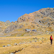
The start of this loop is in the heart of Chamrousse - Recoin, in an almost urban environment. Very quickly, we enter the resort via the GR®738 towards the Balme pass.
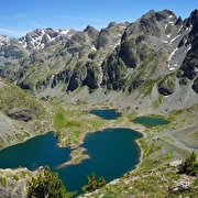
The road then continues to the edge of the Robert Lakes. The atmosphere becomes much more mineral and the black rock contrasts with the emerald green of the water.
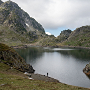
After walking around the two largest lakes, you escape through the northern breach and wind between the blocks before reaching the edge of the Pourettes Lake. This part of the route has several small lakes like this one.
After passing the Pourettes Lake, follow the path towards the starting point. Just before going down to Le Recoin, a superb panorama emerges on the Vercors. On the far, the Mont Aiguille stands alone.
For more informations, visit the website of the "Haute traversée de Belledonne"!
Attention: the shepherd of Chamrousse has dogs with his herd (but no patous), for a good cohabitation between mountain people and the work of the shepherd, thank you for respecting some instructions. Do not cross the herd, do not try to pet or feed the dogs or the herd, do not make sudden gestures or throw things that could frighten the dog, do not start running and avoid taking photos from too close...
☆ Little extra: "Hiking star" a medal for children in summer too!
Showing us a picture taken during their hike, courageous little walkers will be awarded a diploma with their name + gold star "Robert lakes" on sale (3€ at the Tourist Offices) to wear proudly on the backpack.
Route details
Pets welcome
-
Public WC,
-
Parking nearby
Opening
From 15/06 to 15/10 daily.
Subject to snow conditions.
More details
Tips
Panoramic view of the Taillefer
Discover more
-
Robert lakes
Place: Chamrousse
-
Pourettes lake
Place: Chamrousse

-
Chamrousse Tourist Office
Place: Chamrousse

-
House of Heritage and Environment
Place: Chamrousse

-
GR®738 hike - From Chamrousse to La Pra mountain refuge (step 10)
Place: Chamrousse
Elevation 915m
-
Lakes from Chamrousse to La Pra shelter (stage 10 of GR®738 hike)
Place: Chamrousse

-
Chamrousse 1650 - Pourettes lake - Robert lakes by the Brèche Nord
Place: Chamrousse
Elevation 440m

-
Fishing in Robert lakes
Place: Chamrousse
Go there
Latitude : 45.126159
Longitude : 5.879194
Height : 1650
Chamrousse 1650
38410 Chamrousse
Go there
Public transport - stop Chamrousse 1650 - Recoin :
- regular bus service all year round: N93 (to/from Grenoble), "Chamrousse 1650" stop [merger of former T87, Transaltitude, Destination nature Skibus / Estibus 707].
Good to know - another stop less than 500m away (Place de Belledonne, near the Tourist Office):
- bus line / shuttle by reservation on weekdays excluding public holidays: Flexo 57 (to/from Uriage), "Chamrousse - Le Recoin" stop [former TAD TouGo - line G701].
Further information at https://www.itinisere.fr
Information updated on 11/08/2025
by Office du Tourisme de Chamrousse


